| | | Editorial
Dear reader,
at its meeting on 10 July 2026, the Joint Science Conference (GWK) approved both a new Federal-State Agreement (Bund-Länder-Vereinbarung) on the continued funding of the National Research Data Infrastructure (NFDI) for 2028 - 2038 and the continuation of the NFDI second-round consortia, thereby also approving the continued funding of NFDI4Earth by 1st of October.
This is a great success for all of us and recognition of our achievements – so once again many thanks to everyone who contributed to it!
In this respect, we would like to build on the momentum of the first funding phase and invite you to a virtual Kick-off for the second phase in the early afternoon of Friday, 20 November ‘26, starting at 13:00 hrs, where we intend to introduce the new working structure and packages as well as the key areas, the opportunities for cooperation and much more.
Furthermore, as usual, the latest newsletter sets out everything that has happened in the meantime …so, enjoy reading! The NFDI4Earth Newsletter Team
|
|
| | Meet us here - 24 - 25 November 2026: 7. SaxFDM Conference, Dresden
- 01 - 02 December 2026: 14. Deutsches Geoforum, Berlin
Save the Date: NFDI4Earth Plenary, 19 - 21 May 2027
Spot on ... NFDI4Earth
- New functionalities within the GeoFRESH platform
- Data Terra and NFDI4Earth join forces
NFDI4Earth Outcomes - OneStop4All – used and shaped by the community
- NFDI4Earth at Water Research Horizon Conference 2026
- NFDI4Earth at EPOS MSL and Geo.X Annual Meetings
- NFDI4Earth at EOSC Symposium 2026
- Governmental Data for Research Brings Administration and Science Together
- GenAI4Earth showcases AI for Earth System Science in Dublin
News from the RDM & ESS Community - The new NFDI Profile at re3data
- 3Dtrees.earth launches a global platform for AI-ready forest LiDAR data
|
| | NFDI4Earth Live at National and International Events
| NFDI4Earth supports the digital transformation of Earth System Sciences in Germany by advancing shared standards, best practices, and innovative solutions for research data management. Through its distributed infrastructure, the initiative provides FAIR and open access to Earth science data, tools, and data science methods. Throughout 2026, NFDI4Earth has continued to engage with the Earth System Science community at conferences, workshops, and other events. These activities provide opportunities to present our services and resources and explore possibilities for collaboration. We will continue to connect with the community in the coming months, when you’ll be able to meet us at the following events, amongst others. | | | 24 - 25 November 2026: 7. SaxFDM Conference, Dresden, Germany
|
|
| The 7th SaxFDM Conference will take place on 24 to 25 November 2026 at the Leibniz Institute for Solid State and Materials Research (IFW) in Dresden.
Under the motto “Rethinking Research Data: Governance, AI and Sustainable Data Environ-ments”, the conference will explore approaches to research data management, the role of data quality in AI development, the use of AI in RDM as well as the long-term sustainability of research data infrastructures. |
| |
|---|
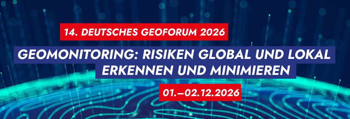
| | 01 - 02 December 2026: 14. Deutsches Geoforum, Berlin, Germany | |
Image credit: Deutscher Dachverband für Geoinformation e.V.
| The 14th German GeoForum will bring together experts to discuss how geomonitoring and geoinformation technologies can help identify and minimise risks at local and global levels. Taking place on 1 and 2 December 2026 in Berlin, the event will focus on the application of geospatial data and technologies to challenges such as climate change, environmental monitoring, critical infrastructure protection and crisis management. Discussions will also address how geoinformation can support sustainable resource use and informed decision-making.
We are taking this event again as a chance to be present alongside a number of our partnering institutions, such as BGR, BKG, 52°North and TU Dresden, both through talks and as part of the corresponding exhibition.
| |
|
|---|
Save the Date: NFDI4Earth Plenary, May 2027 |
|
|---|
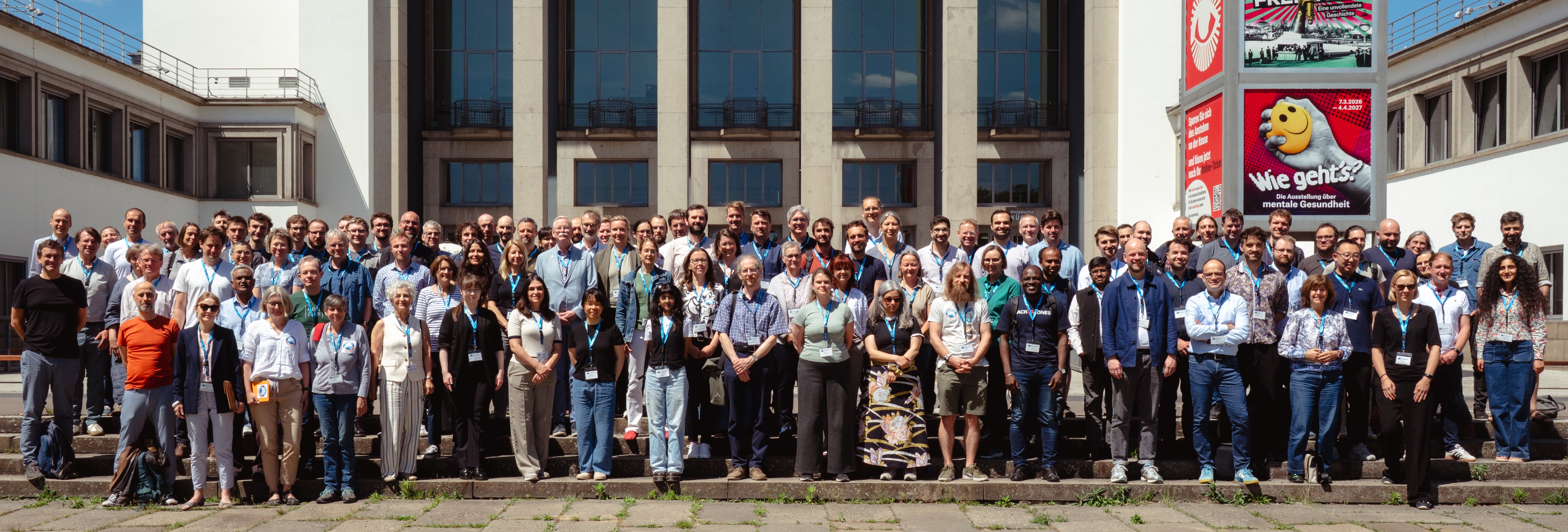
The NFDI4Earth Community 2026. Image credit: Daniel Henzen (TU Dresden) |
|
|---|
The annual NFDI4Earth Plenary meetings at Dresden in the week after Pentecost have now become a cherished tradition – although next year at a new venue:
In 2027, the event will take place from 19 to 21 May at the Saxon State and University Library (SLUB Dresden) and the Open Science Labs Dresden, offering a new setting for our annual gathering.
Join the NFDI4Earth community for three days full of presentations and workshops as well as discussion and collaboration, with the first day, once again set aside for all kinds of side events organised by our community.
Further information on the organisation and programme will follow in due course. |
|
|---|
| | New functionalities within the GeoFRESH platform for freshwater geospatial data processing |
|
|---|
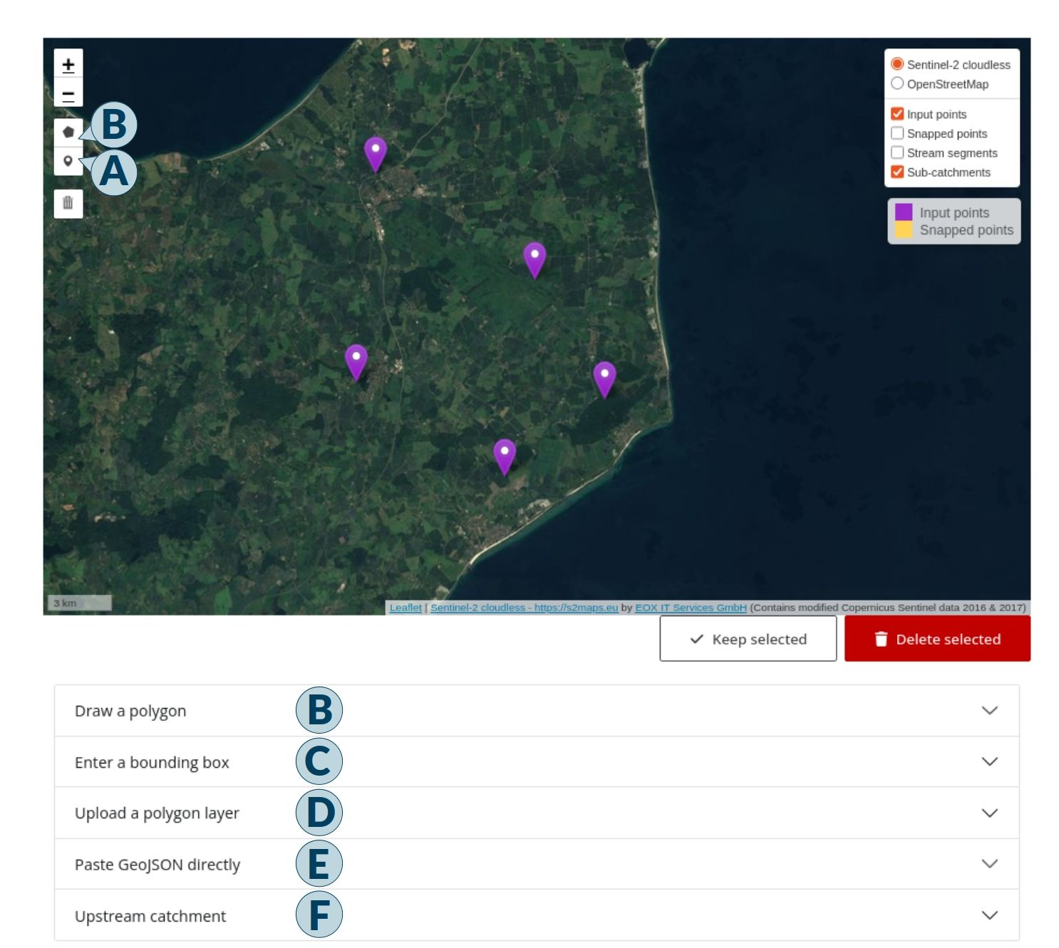
The new Point Editor can be used to insert, move, or delete points interactively. Points can be inserted by placing markers o the map (A) and moved by dragging those markers. Subsets of points can be deleted or kept using selection tools: Polygon selection (B), bounding box (C), uploaded or copy-pasted polygons (D, E), or catchment-based selection (click-to-delineate; F). Screenshot by the authors |
|
|---|
Freshwater geospatial processing is challenged by the dendritic river network and upstream environment impacting any downstream locations. The GeoFRESH web platform, available at geofresh.org addresses this challenge by allowing users to upload point data, ‘snap’ the points to the closest river of a specified Strahler order – a measure for river hierarchy, roughly correlating to river size –, annotate the points with local and upstream environmental data, and download the data for further analyses.
In our third NFDI4Earth Pilot Project (“GeoFRESH3”), we added new functionalities and at the same time, redesigned and restructured the web platform to improve the user experience. Users can now perform basic point editing tasks, and create, upload and apply a custom spatial mask for point filtering. The platform features river-lake intersection analyses, upstream catchment and downstream path delineation tools, mapping barriers given the AMBER barrier dataset, and extracting environmental data.
GeoFRESH hence provides an avenue to support research communities in freshwater sciences by allowing online and simple geospatial processing workflows.
Sami Domisch, Yusdiel Torres Cambas, Vanessa Bremerich & Merret Buurman (all Leibniz Institute of Freshwater Ecology and Inland Fisheries Berlin) |
|
|---|
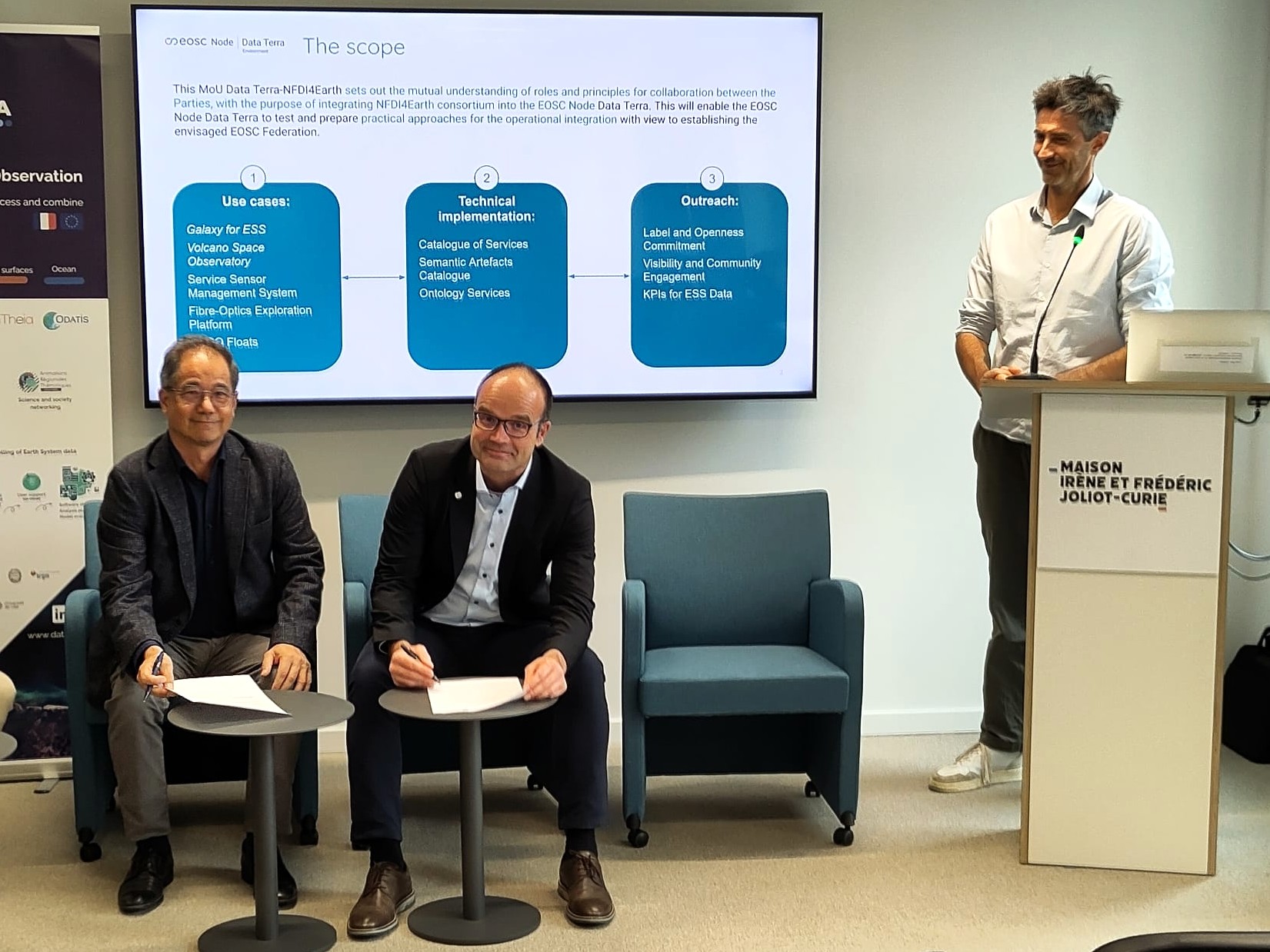
| Data Terra and NFDI4Earth join forces | | Frédéric Huynh, Lars Bernard and Alessandro Rizzo. Image credit: Jörg Seegert (TU Dresden)
| On 7 October in Brussels, the French research infrastructure Data Terra and Germany’s NFDI4Earth consortium brought together leading scientists, infrastructure operators and European decision-makers for a full-day seminar on 'The Future of Interoperable Earth System Data Infrastructures'.
The highlight was the signing of a Memorandum of Understanding between Frédéric Huynh (Data Terra) and Lars Bernard (NFDI4Earth). The agreement sets a framework for long-term cooperation: shared scientific use cases, interoperable services, joint developments and access to complementary expertise and resources. First areas of collaboration are Galaxy for Earth System Sciences, Volcano Space Observatory, Sensor Management System, Fibre-optic observations and more.
What’s coming next? This Franco-German partnership is a first step towards a broader European ecosystem. Advanced discussions are already underway with other research infrastructures and partners, in close connection with ESFRI Research Infrastructures and the ENVRI community.
Our ambition is to develop the EOSC Node Data Terra into an open, inclusive and collaborative European hub for FAIR and interoperable data services supporting Earth system and environmental sciences.
Many thanks to all speakers and participants and especially to Alessandro Rizzo and Jean-Philippe Malet as well as the Data Terra Team, Valentina Protopopova-Kakar and Wolfgang zu Castell who contributed to the event’s extraordinary success!
Data Terra (CNRS Brussels Office), adapted by the NFDI4Earth Newsletter Team
|
| NFDI4Earth Outcomes | OneStop4All – used and shaped by the community |
|
|---|
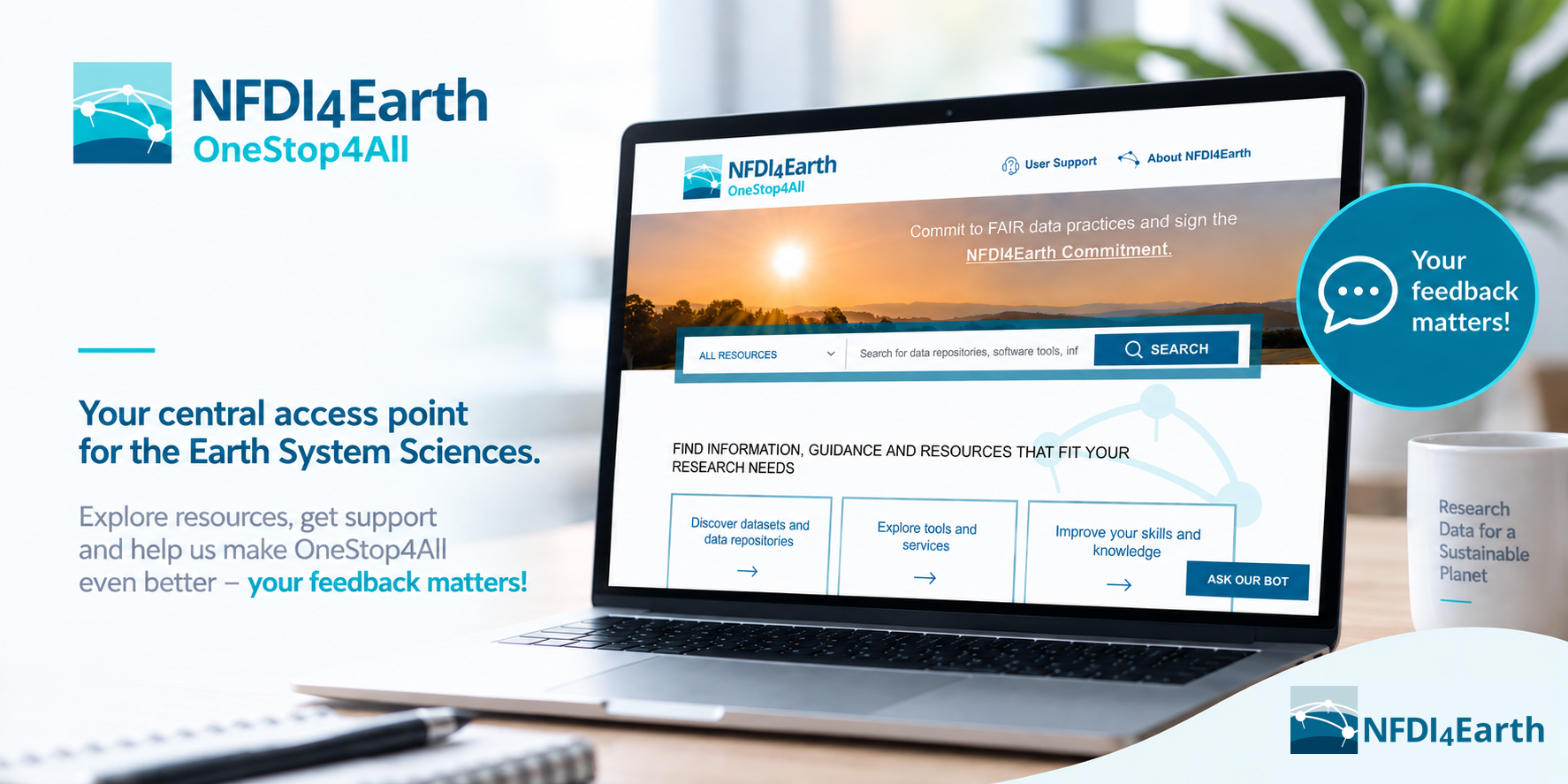
The OneStop4All brings together resources, services, information and support for the Earth System Science community. A first look into usage numbers shows that the portal has a continuous usage, and both new and recurring visitors. Especially community and outreach events help to promote the offerings of NFDI4Earth and result in increased user numbers.
This is encouraging – but usage statistics alone cannot tell us whether users find what they need. In order to continuously improve the OneStop4all, feedback from users is essential. Feedback was collected through workshops, events and the NFDI4Earth User Support Network, and has already helped to identify potential improvements related to content, functionality, usability, accessibility and technical aspects.
Going into the next phase of NFDI4Earth, our goal is to further improve the OneStop4All to be even more useful for you. So, whether you are already familiar with the OneStop4All or have never used it before: give it a try! Explore the portal, search for resources and services – and let us know about your experience via the User Support contact on the OneStop4All webpage. We also strongly welcome suggestions for other topics, resources, services and data sources that would be relevant to your work.
Help us shape the next steps for the OneStop4All!
Sibylle Haßler & Jan Cermak (both Karlsruhe Institute of Technology), Ivonne Anders & Andrea Lammert (both German Climate Computing Center / DKRZ), Ulrike Kleeberg & Marie Ryan (both Helmholtz-Zentrum hereon GmbH), Christin Henzen & Tom Niers (both TUD Dresden University of Technology)
|
|
|---|
NFDI4Earth at Water Research Horizon Conference 2026 | |
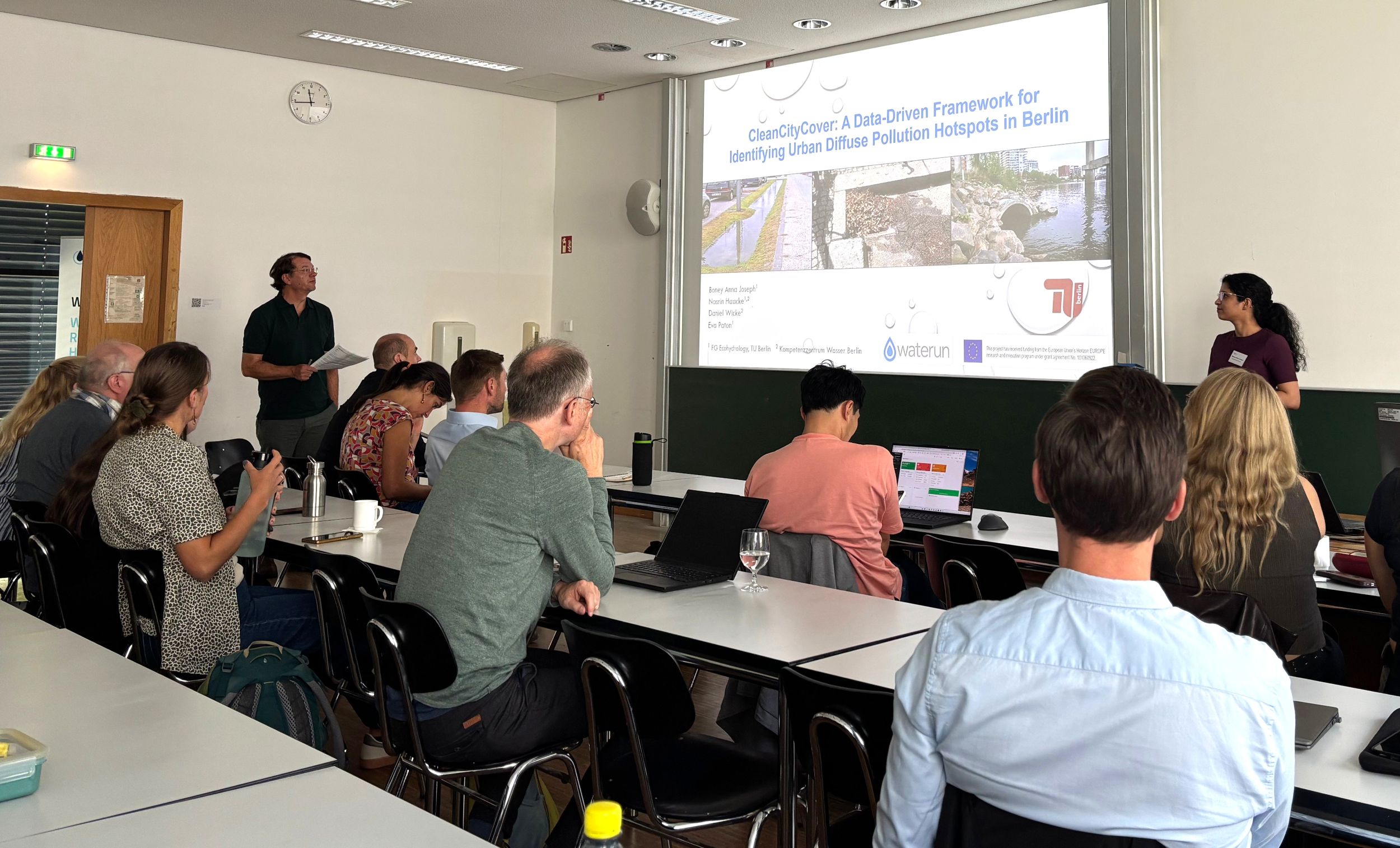
A snapshot from the NFDI4Earth session. Image credit: Tom Niers (TU Dresden)
| Mid of September, the 16th Water Research Horizon Conference (WRHC) took place at the Erwin Schrödinger Center in Berlin, held in alignment with the DGL Annual Meeting. NFDI4Earth participated with two contributions, hosting a session and a hands-on workshop, linking its central services with the research data management needs of the water research community.
Bridging theory and practice, the session 'Future Data for water Future' was accompanied by a hands-on workshop. It invited participants to raise challenges from their daily research data management, including long-term storage, access to governmental data and metadata quality. That set the stage for presenting mainly the OneStop4All, one of the core services developed by NFDI4Earth, which supports Earth System Sciences researchers in both discovering data and choosing where to publish their own. In this context, a new target group has been identified: parts of the so-called 'boomer' generation of scientists who is due to retire in the next few years and has so far rarely published or backed up their valuable research data sets.
A big thank you to both associations hosting the WRHC, the Water Science Alliance (WSA) and the German Limnological Society (DGL), and especially to the local organising committee from the Leibniz Institute of Freshwater Ecology and Inland Fisheries (IGB) and the Humboldt-Universität zu Berlin. Tom Niers & Jörg Seegert (both TUD Dresden University of Technology) |
|
|---|
| NFDI4Earth at EPOS MSL and Geo.X Annual Meetings | |
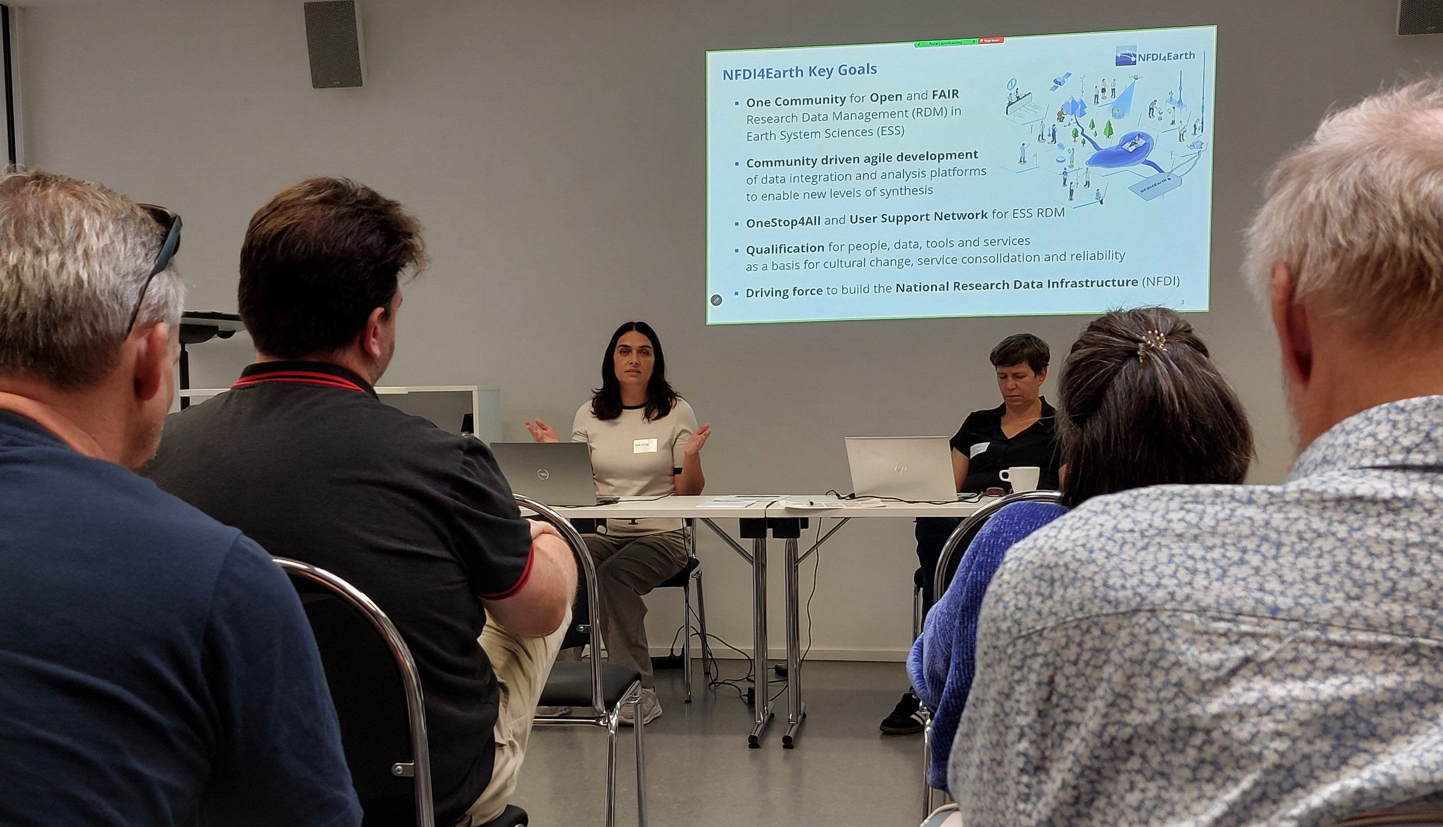
Valentina Protopopova-Kakar and Kirsten Elger (GFZ Potsdam). Image credit: Ronald Pijnenburg | On 29 September 2026, NFDI4Earth participated in two annual events at Potsdam and Berlin, strengthening connections with the geoscientific community and highlighting opportunities for collaboration.
The EPOS Multi-Scale Laboratories (MSL) Annual Meeting, held in Potsdam, brought together local laboratory experts and representatives of European experimental and analytical laboratories and data repositories. The meeting provided a valuable opportunity to exchange experiences and explore synergies between research laboratories.
From an NFDI4Earth perspective, discussions highlighted the potential for closer collaboration between national research data infrastructures and European research infrastructures such as EPOS ERIC. The event also offered an opportunity to raise awareness of NFDI4Earth’s role in supporting the German Solid Earth community and to encourage stronger national engagement in support of full membership in EPOS.
In the afternoon, NFDI4Earth joined the Geo.X Annual Meeting at Freie Universität Berlin, held under the theme Landscapes over Time”. The event provided a platform for fruitful discussions and networking among early-career researchers, peers, and invited guests, such as members of the EPOS MSL community. Geo.X, the geoscientific competence network in Berlin and Potsdam, has been the "driving force" behind the NFDI4Earth Academy over the past five years.
During the event, NFDI4Earth showcased its data services and education and training portal, highlighting resources that support researchers in discovering, managing, and reusing research data, as well as developing their skills.
Valentina Protopopova-Kakar (GFZ Helmholtz Centre for Geosciences) | |
|
|---|
NFDI4Earth at EOSC Symposium 2026 | |
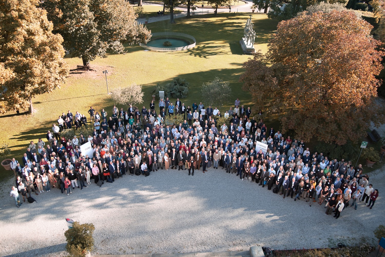
EOSC Symposium 2026 group picture. Image credit: Fotograficacongressi / William Castaldo
| Just a few days after signing the Memorandum of Understanding, NFDI4Earth and Data Terra demonstrated their partnership at the EOSC Symposium from 14 to 16 October 2026 in Florence where about 500 participants from 35 countries gathered for their annual meeting. Fourteen operational EOSC nodes now offer various services, and NFDI4earth is now right at the heart of it – as part of the EOSC’s thematic node Data Terra with a clear focus on Earth and Environmental Sciences.
Powered by the Franco-German partnership, the node offers researchers a single point of entry to FAIR-and AI-ready Earth system, biodiversity and environmental data, cross-domain services, and virtual environments, supporting cross-border and cross-disciplinary research on global environmental related challenges, such as climate change adaptation, biodiversity loss and other environmental risks.
An engaging three-day programme was centred on this year’s symposium's theme: connecting users, data, and services, and all national and thematic nodes were given the chance to showcase their activities and progress in an accompanying exhibition. So we had a great time with the Data Terra team, many inspiring talks and exchanges - also with international colleagues - on the expansion and a broader profile of the node as well as future collaborations.
Alongside our thematic EOSC node, NFDI4Earth linked EOSC projects were presented, such as AquaINFRA, as well as the EOSC Node Germany which is to be established in the coming years by the overall NFDI as the mandated organisation for Germany in the EOSC Association and one of our relevant points of cooperation complementing our community driven thematic service offerings.
So stay tuned – in the spirit of a future European Data Ecosystem!
Jörg Seegert (TUD Dresden University of Technology)
|
|
|---|
| Breaking Down Barriers: Governmental Data for Research Brings Administration and Science Together |
|
|---|
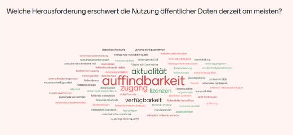
Results of the interactive Mentimeter poll: the word cloud shows the challenges participants consider most significant when using public data, with findability and timeliness ranking among the top answers. Screenshot by the authors
| On 8 October 2026, the online workshop "Governmental Data for Research - Administration and Research in Dialogue" brought together more than 70 participants from public authorities, research institutions, and research data infrastructures. Organised as part of NFDI4Earth Measure "Governmental Data", the interactive forum explored how governmental geospatial and environmental data can be provided, linked, and reused to support both public administration and scientific research. Using urban climate adaptation as a common use case, speakers from GDI-DE, GFZ, the Urban Data Platform Hamburg, DKRZ, and TU Dresden presented existing data services and practical pathways towards FAIR and interoperable data provision.
The lively discussion session highlighted the challenges that currently hinder the use of public data: an interactive poll revealed that findability, timeliness, access, licensing, and availability are considered the biggest obstacles when working with governmental data (see figure). Participants welcomed the exchange between authorities and science as highly valuable and suggested building on existing formats such as the GDI-DE working groups to continue the dialogue. The results will be summarised in a workshop report together with the presentation slides, and will feed directly into the preparation of an in-person follow-up workshop planned at the NFDI4Earth Plenary from 19-21 May 2027 in Dresden.
Astrid Ziemann (TUD Dresden University of Technology) Klaus-Peter Wenz & Dorothee Jahaj (both Federal Agency for Cartography and Geodesy / BKG)
| | GenAI4Earth showcases AI for Earth System Science in Dublin |
|
|---|
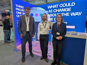
On 14 October 2026, the Technical University of Munich (TUM) presented the European GenAI4Earth consortium at the International AI Summit in Dublin, alongside the EOSC-ARENA and FLUID-AI projects. GenAI4Earth develops trustworthy and resource-efficient generative AI tools for Earth System Science, connecting multimodal observations, scientific knowledge and computational models to support scientific discovery.
The initiative explores applications such as urban resilience and emphasises transparency, reproducibility and human oversight. Its work is closely connected to NFDI4Earth, fostering collaboration on the use of generative AI and research data in Earth System Science. |
| |
|---|
| TUM contributes to the development of an urban data space that combines multimodal data and generative AI to generate insights for urban resilience. The project highlights the potential of AI to support scientific discovery while keeping research processes transparent and reproducible.
TUM Professorship for Big Geospatial Data Management, adapted by the NFDI4Earth Newsletter Team
|
|
|---|
| News from the RDM & ESS Community | The new NFDI Profile at re3data |
|
|---|
NFDI4Earth is supporting re3data, the Registry of Research data Repositories, in updating an initial group of repositories and assigning the NFDI profile.
The background to this is that re3data has recently expanded its ‘Suggest’ form and included the NFDI profile in its metadata schema under ‘Profiles’ in the ‘Standards’ section. On the one hand, this helps researchers to identify repositories that are directly linked to NFDI4Earth and NFDI; on the other hand, it supports a systematic inventory across disciplinary boundaries. Repositories in which at least one NFDI4Earth participant or co-applicant is involved are eligible for inclusion in the NFDI profile. NFDI4Earth has so far identified around 90 repositories that are currently linked directly to NFDI4Earth in this way via at least one NFDI4Earth partner.
Firstly, there is considerable effort involved in submitting individual change requests and updating repository metadata. Secondly, re3data forms the basis for the 'NFDI4Earth Label' assessment. Therefore, it is important that the inclusion of these repositories in the NFDI profile is accompanied by a review and update of the metadata by re3data. The NFDI profile can be added either internally via re3data or via an individual change request. This also offers the opportunity to carry out a more comprehensive update of the metadata or to make any necessary subject-specific additions.
Are you a research data repository operator - then please update your entry in re3data and, in particular, check whether the NFDI profile has been configured in line with your requirements. For support, please contact us directly or at info@re3data.org.
Claudia Müller (Alfred Wegener Institute, Helmholtz Centre for Polar and Marine Research) Christin Henzen (TUD Dresden University of Technology) Charlotte Neidinger & Robert Ulrich (both Karlsruhe Institute of Technology) Robert Brylka (Senckenberg – Leibniz Institution for Biodiversity and Earth System Research)
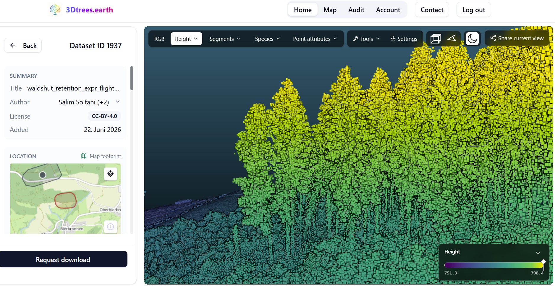
| | 3Dtrees.earth launches a global platform for AI-ready forest LiDAR data | | Screenshot: 3Dtrees.earth
| Forests are three-dimensional ecosystems, but the LiDAR point clouds needed to describe their structure are often difficult to access and analyse. 3Dtrees.earth is a new community-driven platform for contributing, discovering, visualising, processing and publishing forest LiDAR data. It emerged from lessons learned through the NFDI4Earth-supported platform deadtrees.earth. While deadtrees.earth focuses on crowdsourcing drone-based aerial imagery and has collected more than 9,000 images worldwide, 3Dtrees.earth focuses on the three-dimensional structure of forests using mobile laser scanning (MLS), UAV laser scanning (ULS) and terrestrial laser scanning (TLS). Users can apply advanced AI methods such as individual-tree identification and species classification.
For scalable processing, 3Dtrees.earth builds on Galaxy Europe, enabling many computationally intensive workflows to run in parallel in the cloud. By connecting community-contributed data with advanced analytical tools, interactive 3D visualisation and publishing capabilities, the platform will provide a shared resource for forest and Earth observation research. Its growing collection of harmonised datasets can support macroecological studies and provide valuable training and validation data for satellite- and drone-based Earth observation products.
Teja Kattenborn (University of Freiburg)
|
|
|---|
| The NFDI4Earth project has been funded by the German Research Foundation (DFG) through the project NFDI4Earth (DFG project no. 460036893, https://nfdi4earth.de/) within the German National Research Data Infrastructure (NFDI, https://www.nfdi.de/). |
|
|---|
| NFDI Consortium Earth System Sciences | https://nfdi4earth.de
edited by: Valentina Protopopova-Kakar (GFZ Helmholtz Centre for Geosciences) & NFDI4Earth Coordination Office (TUD Dresden University of Technology)
Report news to: nfdi4earth-news@tu-dresden.de | |
|
|---|
|
|