At its core, Earth System Sciences aims to unravel the complex processes that drive the Earth as a dynamic system. This includes the fluxes of matter and energy in the five main spheres - the geosphere, hydrosphere (including the cryosphere), atmosphere, biosphere and anthroposphere (cf. Leopoldina’s report Earth System Science: Discovery, Diagnosis, and Solutions in Times of Global Change).
Data acquisition, simulation, integration, and analysis are crucial to understanding these complex processes. The Earth System Sciences community already embraces many Open Science practices, including making its many types of research outputs findable, accessible, interoperable, and reusable for humans and machines (as stated in the The FAIR Guiding Principles for scientific data management and stewardship). Equal priority should be given to data management and analysis tools that enable data-driven methods. Efficient and effective use of research outputs, facilities, and funding, as well as appropriate reward systems and recognition of all research activities are equally important parts of Earth System Sciences data activities.
NFDI4Earth - the consortium for the Earth System Sciences within the National Research Data Infrastructure (NFDI) - aims to become a central facilitator for research data management in the German Earth System Sciences community, enabling more open knowledge sharing. The mission of NFDI4Earth is to provide easy, efficient, open and, as far as possible, unrestricted and standardised access to all relevant Earth system data, scientific data management and data analysis services, and to ensure sustainable and quality-assured research data management infrastructures.
This commitment will help to engage the NFDI4Earth community in shaping, promoting, and implementing the NFDI4Earth agenda. In the longer term, the results of this work will also help to drive the much needed change in the way research is evaluated, as expressed in the DORA and CoARA declarations.
NFDI4Earth invites institutions and individual researchers, laboratories, infrastructure providers, publishers, academic societies, government agencies, administrations, industry, funders, and research organisations (see the
list of
signatories) to sign the following statement of commitment and become ambassadors for change towards more FAIR and Open data practices in Earth System Sciences. To support this shift, the NFDI4Earth website provides
background information and guidance for different stakeholders.
Sign the Commitment at http://nfdi4earth.de/commit.
Signatories of the NFDI4Earth FAIRness and Openness Commitment pledge to support NFDI4Earth’s mission, products, and services. The signature of members and/or representatives of the Earth System Sciences community is a public signal of agreement with the goals and values of the Commitment. By collectively supporting the Commitment, the signatories realise NFDI4Earth as a community of practice, taking into account the full range of expertise and all relevant user groups of Earth System Sciences for a sustainable shift towards more FAIR and Open Research.
As signatories...
(1) Commit to the mission of NFDI in bringing together research communities to provide data for the common good, and the role of NFDI4Earth as a facilitator of sustainable, collaboratively developed solutions in Earth System Sciences.
(2) Support and uphold, where appropriate and possible, the principles and values outlined in existing Open Science declarations and statements.
(3) Be familiar with relevant data laws and acts, especially those related to geospatial data, in both national and European jurisdictions. These laws facilitate data sharing at both national and international levels.
(4) Give credit to all sources underlying our research findings and, whenever possible, credit is given through proper citations.
(5) Choose to publish Earth System Sciences data in Earth System Sciences domain repositories and other suitable research infrastructures that meet all four aspects of FAIR principles and consider the specific characteristics of Earth System Sciences data.
(6) Strengthen FAIR and Open Data practices by supporting educational networks, robust training programmes, and the production of educational materials that promote transparency and accessibility of research outputs.
(7) Adopt Data Management Plans as important tools for all research projects. These plans are invaluable for strategically planning data documentation, publication, and collaboratively monitoring data management activities. We seek and consider expert curation and guidance for them.
(8) Where possible, use open and permissive data and software licences that legally enable the envisioned free and open sharing of Earth System Sciences data.
(9) Support and align scientific work with governing bodies and organisations that advance the underlying causes of this commitment.
(10) Recognise the vital role that Earth System Sciences domain repositories and their curation services play in achieving and preserving the highest possible FAIRness and Openness in the Earth System Sciences. As researchers, institutions, and funding agencies, we endeavour to ensure the sustainability of these repositories and other relevant research infrastructures.
(11) Collaborate with data curators and repository managers and leverage their expertise to make Earth System Sciences research outputs transparent, machine-readable, interoperable, and re-usable in the long term. They use diverse approaches, such as the NFDI4Earth Label, to document and advance interoperability across data repositories.
(12) Adhere to and contribute to international standards for harmonising Earth System Sciences data, metadata, data quality, and application programming interfaces (APIs). Support their implementation and development across research infrastructures, as this is crucial for effective interdisciplinary research and advancements in novel analysis methods such as Artificial Intelligence or Machine Learning (AI & ML).


Alfred-Wegener-Institute (AWI)
Contact: Anke Allner
https://www.awi.de


Federal Agency for Cartography and Geodesy (BKG)
Contact: Marcus Brühl
https://www.bkg.bund.de


Leibniz Supercomputing Centre (LRZ)
Contact: leitung@lrz.de
www.lrz.de


Leibniz Centre for Agricultural Landscape Research (ZALF)
Contact: Carsten Hoffmann
https://www.zalf.de


SDI Germany (GDI-DE) represented by the Steering Committee SDI Germany
Contact: Katrin Weke
https://www.gdi-de.org


TUD Dresden University of Technology
Contact: Lars Bernard
https://tu-dresden.de/


GFZ Helmholtz Centre for Geosciences
Contact: Wolfgang zu Castell
www.gfz.de
At the Alfred Wegener Institute (AWI), we believe openness moves science. That is why, together with MARUM, we operate PANGAEA, one of the world’s leading repositories for Earth and environmental data. Our strong research data policies and our contributions to the Helmholtz DataHub Earth and Environment ensure that data is not only stored, but made accessible and useful for everyone. By signing the NFDI4Earth Commitment, we’re reaffirming—and expanding—our dedication to open science and to making data FAIR and we strengthen our ties with the NFDI community.
The Spatial Data Infrastructure Germany (GDI-DE) links geospatial data from all levels of government, making them accessible and interoperable nationwide. As Germany's INSPIRE node, GDI-DE drives FAIR and open geodata use across administration, science and society.
At the Leibniz Centre for Agricultural Landscape Research (ZALF), we explore how agriculture and the environment shape each other. Good research depends on good data, so managing our research data is at the heart of what we do. That’s why we run the BonaRes Repository, a home for valuable soil data, and why we coordinate FAIRagro and contribute to NFDI4Earth. By signing the NFDI4Earth and FAIRagro commitments, we’re pledging to keep our data open, transparent, and useful for the long term.
At TU Dresden, we are committed to building sustainable infrastructures for Earth System Sciences—essential tools for tackling pressing environmental and societal challenges. As the applicant institution of NFDI4Earth, we take this responsibility seriously. By signing the NFDI4Earth Commitment, we’re pledging to actively support and strengthen NFDI4Earth’s mission, products, and services.
The Federal Agency for Cartography and Geodesy (BKG) provides authoritative geospatial reference data for Germany. As a central actor in national and international geodata infrastructures, BKG is committed to FAIR and open data practices that enable science and society to answer the question of “where?” with precision and trust.
 Your name, group, or organisation is missing? Sign the commitment here: nfdi4earth.de/commit.
 Do you have any problems with signing or is your data incorrect? Please contact the NFDI4Earth Helpdesk at helpdesk@nfdi4earth.de.
Full citation: NFDI4Earth Consortium. 2024. NFDI4Earth FAIRness and Openness Commitment (NFDI4EarthDeliverable D4.2.1). NFDI4Earth Community on Zenodo. https://doi.org/10.5281/zenodo.10123880.
You can provide anonymous feedback at https://redcap.zih.tu-dresden.de/redcap/surveys/?s=YKTL79MPMEHDTMAK.
The FAIRagro consortium with more than 30 partners is building a FAIR (Findable, Accessible, Interoperable, Reusable) research data management system for the agrosystems research community. They are developing the tools and workflows to lay the foundations for sustainable crop production – now and in the future. In March 2025, FAIRagro published their version of the NFDI4Earth Commitment with minor adjustments to address the agro community.
https://fairagro.net/en/commitment

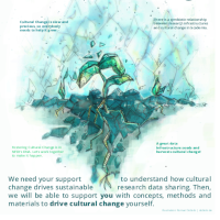
Without cultural change there is no sustainable research data sharing. That is why in 2023, members of several NFDI consortia came together to discuss the challenges and opportunities of sharing research data with and through the NFDI. In several online workshops and publications they investigate how cultural change can promote use of infrastructures, and how infrastructures can promote cultural change. Because data shall grow - and we with it.
https://cc-by-us.gitlab.io/

There are various ways how organisations can implement the NFDI4Earth FAIRness and Openness commitment. These ways depend on the organisation type, the current policies regarding FAIRness or Openness, the policies of parent organisations, ... to name just a few. The NFDI4Earth Commitment team facilitates an exchange between institutional signatories on their actions and goals. Your institution can join this exchange as a signatory, too!
Here are some examples for activities an organisation can take, in part based on the internal plans for existing signatories:
Find more examples in the Living Handbook article on the NFDI4Earth Commitment: https://onestop4all.nfdi4earth.de/result/lhb-docs-N4E_FAIRness-and-Openness-Commitment.md
This work has been funded by the German Research Foundation (DFG) through the project NFDI4Earth (TA4 M4.2, DFG project no. 460036893, https://www.nfdi4earth.de/) within the German National Research Data Infrastructure (NFDI, https://www.nfdi.de/).
We thank all contributors from the NFDI4Earth community and beyond for their questions, feedback, edits, and their inspirational work that this commitment is grounded on. People who have agreed are listed in alphabetical order below using CRediT and as contributors on the Zenodo record. We also extend our sincere thanks to all unnamed contributors for their inputs, be they small, indirect, or given in passing, from the NFDI4Earth community and beyond, especially the members of the NFDI4Earth steering group and the participants of the in-person workshop "Towards a Cultural Change in ESS RDM" at the 3rd NFDI4Earth Plenary in Dresden in May 2024.
Lars Bernard - Conceptualization, Funding acquisition, Supervision, Writing – review & editing
Peter Braesicke - Writing – review & editing
Kirsten Elger - Conceptualization, Methodology, Writing – review & editing
Frank Oliver Glöckner - Supervision
Christina Habermehl - Writing – review & editing
Dominik Hezel - Writing – review & editing
Andreas Hübner - Conceptualization, Methodology, Writing – review & editing
Carsten Keßler - Writing – review & editing
Marthe Klöcking - Supervision, Writing – review & editing
Melanie Lorenz - Conceptualization, Methodology, Writing – original draft, Writing – review & editing
Daniel Nüst - Conceptualization, Methodology, Writing – original draft, Writing – review & editing
Najla Rettberg - Supervision
Thomas Rose - Writing – review & editing
Markus Schmalzl - Writing – review & editing
Jörg Seegert - Conceptualization, Methodology, Writing – original draft
Monika Sester - Writing – review & editing
Claus Weiland - Writing – review & editing
